ENDOGENE PROCESSES, NATURAL HAZARDS AND RISK
FUNDED PROJECTS
* Program GeoSust, 22 SEE/30.06.2014 (http://geosust.geo-team.org) (/ http://tinutulbuzaului.org/chihlimbar-si-asezari-rupestre/)
Partners: Institute of Geodynamics of the Romanian Academy, University of Bucharest, Geoecomar Research Institute, Telemarksforsking, Babeș-Bolyai University, Norwegian University of Life Sciences, National Museum of the Romanian Peasant.
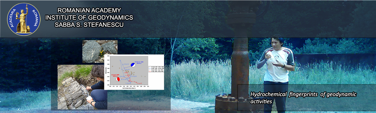
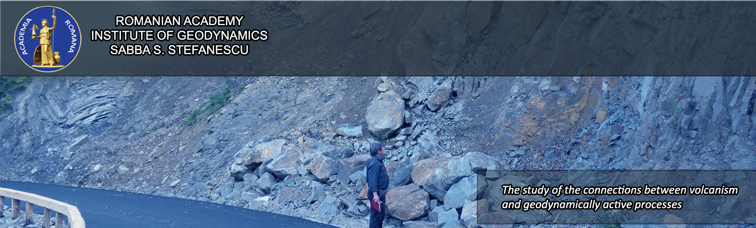
Buzău Land covers an area of approximately 1035.9 km2, located at the Carpathian Bend Area (Romania) in the proximity of the Vrancea seismic zone. The landscape is mostly mountainous and highly dynamic, characterized by steep slopes and abrupt changes of scenery due to geomorphologic diversity. From a geological point of view, it exposes sedimentary rocks dating back from 40 million years ago. Some of the most important geological features of this area include amber, salt diapers, organic rich sediments, deep oil and gas reservoirs and a highly active tectonic system that gives rise to spectacular phenomena such as mud volcanoes, oil brooks, natural gas fires and a vast range of mineralized water springs. It is a completely rural area with poor possibilities for industrial development, inhabited by approximately 40,000 people that live more or less isolated due to the geographic position and lack of proper infrastructure. These underprivileged factors however, allowed the preservation of a unique cultural identity closely linked to the vast natural scenery that hosted its inhabitants for millennia. The local identity and traditional way of living, the spectacular geological elements and the wild area rich in biodiversity, create a potentially economic, but in the same time hazardous frame for inhabitants and visitors. Debris flows and landslides affect daily lives and properties, blocking access roads at least twice a year; mud volcanoes extend dangerously close to villages; gas fires have the potential to start spontaneously and explosively and gas seepage is not recorded, making it impossible to predict the likelihood and location of future combustions. The levels and distribution of natural radiation, commonly associated to organic rich rocks are not quantified. Many of the mineralized waters that are traditionally used for therapeutic purposes have to be systematically analyzed in order to establish their source and quality before being further used.
Considering most of these factors and the economic disparity between Buzău Land and nearby areas, a UNESCO Geopark initiative was proposed by the University of Bucharest in 2007, as a solution to these issues and as a mean to improve the quality of life and to build a local sustainable economy. Since then, efforts towards raising the local public awareness, mobilizing decision-makers and building the necessary administrative framework for a Geopark, have been carried out.
This project brings together experienced research entities, the Geopark initiators and its official working group (Geo-Team), with the aim of assisting the Buzău Land Geopark initiative and to create a solid scientific and logistic background that will lay the foundation on which future environment and local management actions will be based on. The project’s target is to acquire and apply scientific knowledge for sustainable development and correct management of the natural and cultural environment under the principles of geoconservation. This includes mitigating the effects of the natural hazards and creating the on-field logistics for education, geo-tourism and awareness towards local natural heritage. Here-in, we propose 6 main objectives that are to be accomplished by the interdisciplinary team involved in this project:
(1) develop and implement natural hazard and risk maps for environmental management and risk assessment,
(2) develop tools for physical planning based on a centralized inventory of sites relevant for geoconservation,
(3) improve knowledge of how the natural environment has inspired the local human imaginary and customs over time, based on an intangible heritage inventory,
(4) create strategies and tools for geo-education, public awareness and economic development,
(5) create the means for predicting the regional impact of natural phenomena and climate change via GIS platform,
(6) create the Geopark Management Plan to seek balance between economic development and environmental protection.
RESEARCH FIELD
In constructie!
MAIN TOPICS
In constructie!
RESEARCH INFRASTRUCTURE
Under construction !
RESEARCH STAFF
I am text block. Click edit button to change this text. Lorem ipsum dolor sit amet, consectetur adipiscing elit. Ut elit tellus, luctus nec ullamcorper mattis, pulvinar dapibus leo.
Tatu Mihai - e-mail: mtatu@geodin.ro
CURRICULUM VITAE
Seghedi Ioan - e-mail: seghedi@geodin.ro
CURRICULUM VITAE
Niculae Lucica – e-mail:
CURRICULUM VITAE
Iatan Elena Luisa – e-mail: luisa.iatan@geodin.ro
CURRICULUM VITAE
Mirea Viorel – e-mail:
CURRICULUM VITAE
Popa Razvan Gabriel – e-mail:
CURRICULUM VITAE
Bacargis Gabriela – e-mail:
CURRICULUM VITAE