

Program: |
IDEI |
Project type: |
Exploratory research projects |
Project Cod: |
PCE-2012-4-0137 |
OBJECTIVES / ACTIVITIES
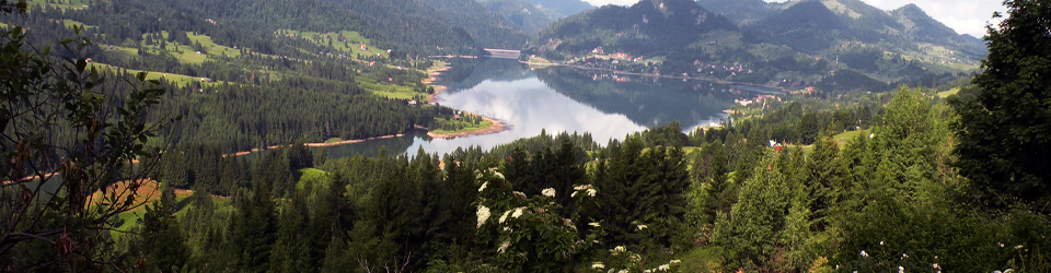
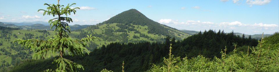
1. Analysis/critical review of current models for geodynamic evolution of the Eastern Carpathians, as part of the CPR and its inter-connection with magmatic activity.
2. Building up a computer data-base of geological and geophysical data for the studied area.
3. Identification and deciphering the space-time relationships of the main volcanic structure and intrusive bodies, their interval of emplacement using K/Ar dating, petrological, geological and geophysical data; establishing the geological significance of the combined geophysical anomalies and identification of hidden intrusive bodies;
4. Identification and characterization of the main tectonic alignments associated to, or in close association with magmatic activity by using geological and geophysical data; identifying the orientation of extensional and compressional stress fields;
5. Building-up 3D images for selected volcanic structures and hidden intrusive bodies based on the geologic interpretation of geomagnetic and gravity models, in order to assess their volume, emplacement and evolution;
6. Proposing a complex novel regional model for the emplacement of various volcanic structures and intrusive bodies in close connection with geodynamic processes and comparing with similar geological situations in the world.
- Structure -
Year |
Stage |
Objective |
Activity |
Outcomes/Deliverables |
2013 |
1 |
1.1. Building up the GIS compatible computer database for the Study Area(I) |
1.1.1. Documentation. Obtaining licence allowance from National Agency for Mineral Resources for the researchers working in the project in order to consult and use unpublished data for the study region. |
Stage study 1: Documentation |
1.1.2. Defining GIS levels and structuring database |
Stage study 1: Database methodology |
|||
1.1.3. Organising database on specific levels |
Stage study 1: Database methodology |
|||
1.1.4. Electronic transfer of the topographic data. Building up the DTM |
Stage study 1: Building up the regional digital terrain model |
|||
1.2 Analysis and critical discussion of the current models associated to geodynamic evolution of the East Carpathians in connexion with Miocene-Quaternary magmatic activity (1). |
1.2.1. Realizing a synthesis of the existent data from published and unpublished material |
Stage study 1: Activities related to data synthesis |
||
1.3. The identification and description of the main tectonic alignments that were associated with magmatic activity, based on fieldwork geological and geophysical activities - (I) |
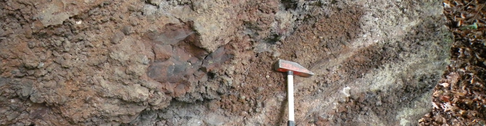
1.3.1. Fieldwork activities for in situ mapping of the tectonic elements and their connection with the volcanic structures (intrusive and effusive). Sampling for petrographic, petro-physic and geochemical analyses. |
Stage study 1: Interpretative geological profiles |
2014 |
2 |
2.1. Building up the geological and geophysical GIS compatible computer database for study area (II) |
2.1.1. Continuation of the organisation on the specific levels of GIS geological database |
Stage study 2: Geological maps with attribute type tables |
2.1.2. The transfer of the gravity information on electronic support and database validation |
Stage study 2: Models of gravity field |
|||
2.1.3. The transfer of the ground geomagnetic information on electronic support and database validation |
Stage study 2: Models of ground magnetic field |
|||
2.1.4. The transfer of the aeromagnetic information on electronic support and database validation |
Stage study 2: Models of aeromagnetic anomaly |
|||
2.1.5. The transfer of additional information on electronic support and database validation |
Stage study 2: Complementary geophysical models |
|||
2.1.6 The transfer of rock physics information on electronic support and database validation |
Stage study 2: Tables with petro-physic data |
|||
2.1.7 The transfer of drilling information on electronic support and database validation |
Stage study 2: Tables with drilling data |
|||
2.1.8. Updating thematic databases with the results from the second stage |
Stage study 2: Updating data base |
|||
2.2 Analysis and critical discussion of the current models associated to geodynamic evolution of the East Carpathians in connexion with Miocene-Quaternary magmatic activity (II). |
2.2.1. Gravity echoes of the current geological concept |
Stage study 2: maps and 2D interpretative models along representative profiles |
||
2.2.2. Geomagnetic echoes of the current geological concept |
Stage study 2: maps and 2D interpretative models along representative profiles |
|||
2.2.3. The analyses of the way the geologic concept is reflected in other geophysical information categories |
Stage study 2: maps and 2D interpretative models along representative profiles |
|||
2.3. The identification and description of the main tectonic alignments that were associated with magmatic activity, based on fieldwork geological and geophysical activities - (II) |
2.3.1. Integration of the K/Ar age data, petrologic and geophysical data of the volcanic and subvolcanic structures in the study area |
Stage study 2: Tables and explanatory notes related to the correlation of age and petrologic data, followed by specific interpretation diagrams for the study area |
||
2.3.2. Field and laboratory activities for new geological and geophysical data acquisition in order to solve the relationship between tectonic and volcanic structural features. Rock sampling for specific geochemical and petro-physical analyses (1). |
Stage study 2: Complex geological-geophysical maps for the study area |
|||
2.3.3. Advanced data processing aimed at providing more intuitive images for helping geological interpretation |
Stage study 2: Maps of gravity / geomagnetic fields and complex anomalies for the study area |
|||
2.4. Dissemination activities |
2.4.1. Attending national and international conferences in proposed thematic |
2 presentations/abstracts |
||
2015 |
3 |
3.1. Building up the geological and geophysical GIS compatible computer database for study area. (III) |
3.1.1. Completion of the existent data bases with the results obtained during the fieldwork of the 3rd stage |
Stage study 3: Updating the thematic data bases |
3.1.2. Field and laboratory activities for new geological and geophysical data acquisition in order to solve the relationship between tectonic and volcanic structural features. Rock sampling for specific geochemical and petro-physical analyses (2). |
Stage study 3: Complex geological-geophysical maps for the study area |
|||
3.2. Realizing 3D images for selected volcanic structures and hidden intrusive bodies based on the complex geological and geophysical (magnetic and gravity modelling) (I) |
3.2.1. Geological and geophysical data processing in the view of 3D model elaboration, by using all the data collected on the specific levels |
Stage study 3: Geological and petro-physical 2D preliminary models for volcanic structures in the South Harghita - Perşani and Rodna - Bârgău- Călimani de Nord areas to be prepared for the 3D modelling. |
||
3.3. Dissemination activities |
3.3.1. Attending national and international conferences in proposed thematic |
2 oral or poster presentations/abstracts |
||
3.3.2. Publishing articles in the proposed thematic |
1 published ISI article |
2016 |
4 |
4.1. Building up the geological and geophysical GIS compatible computer database for study area. (IV) |
4.1.1. Database completion of the data with the results from the 4th stage |
Final stage: Updating thematic databases |
4.2. The identification and description of the main tectonic alignments that were associated with magmatic activity, based on fieldwork geological and geophysical activities (III) |
4.2.1. Laboratory and geological fieldwork to identify the different types of tectonic stress, compressional or extensional. |
Final stage: Thematic maps with distribution of the main structural alignments tectonic elements as respecting the extensive or compressive behaviour in the investigated area |
||
4.2.2. Gravity and magnetic observations along rock sampling for rock physic determination in poorly studied areas. |
Final stage: Gravity and magnetic profiles in areas geologically investigated; Density and magnetization values included. |
|||
4.2.3. Advanced processing of the geophysical data and generation of simulation models for the anomaly sources in order to identify the hidden structural elements |
Final stage: Maps showing the geophysical alignments in areas geologically; interpretative sections |
|||
4.3 Realizing 3D images for selected volcanic structures and hidden intrusive bodies based on the complex geological and geophysical (magnetic and gravity modelling) (II) |
4.3.1. Generation initial 3D models of the numeric simulation (version 0) |
Final stage: Preliminary geological and petro-physical 3D models |
||
4.3.2. Iterative process to realize 3D models of the gravity and magnetic source anomalies in the study area |
Final stage: 3D Geophysical models (geometric and petro-physic) of the sources with observed anomalies |
|||
4.3.3. Geological interpretation of the 3D geophysical models realized by using numeric simulation. |
Final stage: 3D geological models improved with geophysical data interpretation |
|||
4.4 Building up integrated conceptual complex geological-geophysical model in order to explain the architecture of the volcanic structures and intrusive bodies with consequences on the Miocene-Quaternary geodynamic processes in the East Carpathians |
4.4.1. Qualitative integrated interpretation of the geological and geophysical information under constraint offered by the data of different nature |
Final stage: Complex maps that integrate geological and geophysical data |
||
4.4.2. Completion in the study area of the qualitative interpretations of the data with qualitative ones offered by the 2D and 3D simulation models |
Final stage: Integrated geodynamic model based on the whole geological and geophysical data. Final study. |
|||
4.5. Dissemination activities and results |
4.5.1. Attending national and international conferences in proposed thematic with oral and/or poster presentations |
2 oral or poster presentations/abstracts |
||
4.5.2. Articles publication |
2 articles published in ISI ranked journals |